
A Vision for a Resilient Kachemak Bay Watershed
By Hal Shepherd

HAPPY EARTH DAY!
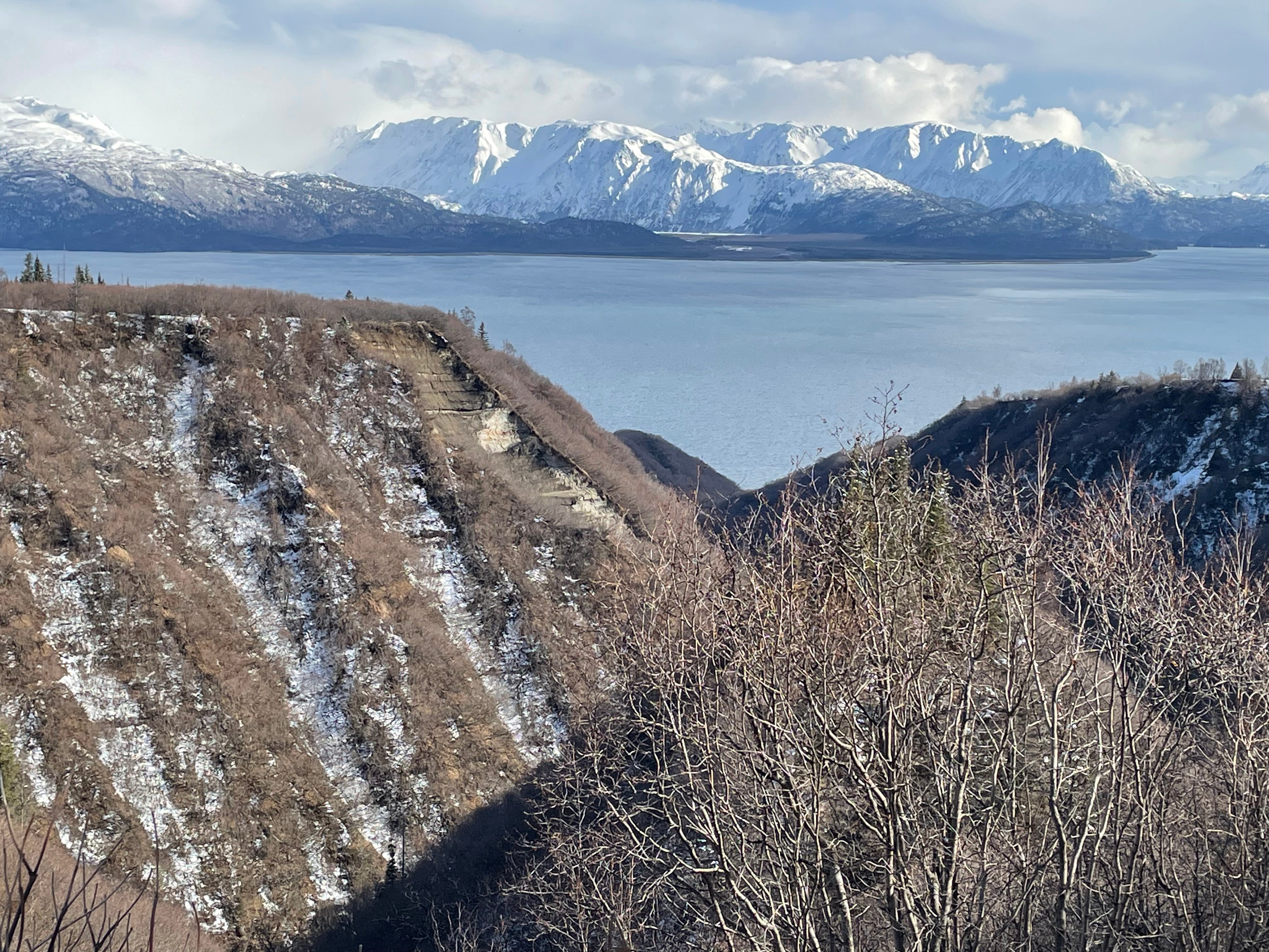
Over the past week, as I wrote this article for posting on Earth Day, I have been looking out of my office window at the East End of Kachemak Bay and thinking about the history of environmentalism in the region. In fact, around the first Earth Day celebration, almost fifty years ago, the Alaska legislature, had the foresight to establish the Kachemak Bay Fox River Critical Habitat Area “to protect and preserve habitat areas especially crucial to the perpetuation of fish and wildlife, and to restrict all other uses not compatible with that primary purpose.” At about the same time, the legislature established the Kachemak Bay State Park and Kachemak Bay State Wilderness Park to “protect and preserve this land and water for its unique and exceptional scenic value….” Then, in 1980, Congress established the Kenai National Wildlife Refuge, which extended protection to fish habitat within the Watershed by creating contiguous “green” corridors along inter-jurisdictional anadromous streams.
Together, these withdrawn lands protect important habitat for wildlife, shellfish, fish, marine mammals, and tens of thousands of shorebirds, sea birds, and waterfowl. More importantly, with climate change beginning to take a toll on the Bay’s ecosystem, we need these unique areas to serve as a sanctuary or at least a place where climate-related impacts affecting fish and wildlife can be kept to a minimum.
Many watershed systems in the Lower 48 are referred to as “impacted” or “non-supporting,” meaning that, due to human activities, they do not retain their original hydrologic functions, channel stability, habitat, water quality, or biodiversity. These water bodies, therefore, have degraded to the point where it may no longer be possible to restore them to their predevelopment conditions.
It may be hard to believe, but largely due to climate change, watersheds throughout Alaska are beginning to experience the same kinds of degradations that have been on-going Outside for many years. The Kachemak Bay Fox River Watershed, for example, is already showing signs of dramatic impacts on plants and animals including warming fresh and marine water temperatures, increasingly common drought conditions, and spruce beetle outbreaks, that are occurring at a rate no one thought possible even a decade ago.
In response to this threat, the local tribal consortium is inviting stakeholders to participate in a Collaborative that will focus on sustainable management of the Kachemak Bay Watershed. The Chugach Regional Resource Commission (CRRC) is an Alaska Native Tribal consortium whose Dena'ina, Alutiiq, and Sugpiaq village communities of south-central Alaska have relied on a subsistence economy since time immemorial.
CRRC’s seven-member tribes represent the greater Chugach region of Southcentral Alaska, including Lower Cook Inlet, Resurrection Bay, and Prince William Sound. Their mission is to promote Tribal sovereignty and protect subsistence lifestyles through the development and implementation of Tribal natural resource management programs to assure conservation and sustainable economic development in the traditional use areas of the region. As part of this mission, CRRC is working with area member tribes and other stakeholders to establish the Kachemak Bay Watershed Collaborative to promote resilient fish and wildlife habitat within the Watershed.
The Kachemak Bay Watershed is actually comprised of five small watersheds that encompass the municipalities of Homer, Kachemak Selo, Voznesenka, Razdolna, Seldovia, and the unincorporated Alaska Native village communities of Nanwalek and Port Graham. The Watershed also includes jurisdictional boundaries of the almost two million-acre Kenai National Wildlife Refuge managed by the U.S. Fish and Wildlife Service, the 371,000-acre Kachemak Bay State Park and Kachemak Bay State Wilderness Park managed by the Alaska Department of Natural Resources and the 229,000-acre Kachemak Bay Fox River Critical Habitat Area. Finally, the Watershed includes a diverse array of stakeholders, including livestock grazers, tourist and recreation groups, industry, environmental organizations, recreation advocates, universities, land use, tribal, state, and federal entities, municipalities, and the general public utilize the area.
Despite its complex stakeholder interests and diversity of management entities, until recently, management decisions regarding the various land designations and resource uses have largely excluded input from Alaska Native communities who have stewarded the Watershed for over 10,000 years. Similarly, while “Management on a watershed basis” has become a catchphrase among federal and state agencies outside of Alaska as a means of meeting mandates for addressing sustainable resource management and climate-related impacts to natural resources, such a strategy so far has yet to reach beyond the jurisdictional boundaries of federal, state and borough land management agencies The Watershed Collaborative will, therefore, work to be more inclusive of tribal and other local communities along with local, state, and federal agencies and encourage that monitoring, planning, and decision-making be made using an ecosystem wide approach.
To this end, once the Collaborative is established, it will conduct pre-planning activities including sharing data gathered, identifying data gaps, outlining a watershed restoration plan, researching existing plans related to the watershed, collecting baseline information, and identifying restoration needs. There are several ongoing or previous watershed planning efforts related to the Watershed that the Collaborative ultimately, would seek to participate in including: 1) Risk assessments of current threats to salmon habitat within a portion of the Watershed addressing salmon habitat connectivity and climate resiliency for the entire Watershed; 2) Management planning to maintain and enhance fish and wildlife habitat and other values identified by the Critical Habitat Area, State Park and State Wilderness Park and Wildlife Refuge to minimize the degradation and loss of habitat values due to fragmentation, and cumulative impacts when considering effects of small incremental developments and action affecting critical habitat resources; and 3) The creation of contiguous “green” corridors along anadromous streams, in order to increase the resiliency of these streams and the marine habitat into which they feed from the effects of a rapidly warming climate.
The Kachemak Bay Watershed Collaborative will bring a shared vision for protecting and sustaining the biologically rich Watershed as envisioned by the legislation which established the Critical Habitat Areas, the State Parks and Wilderness and the Kenai Wildlife Refuge. This can best be accomplished by managing the watershed as a whole instead of the piecemeal jurisdictional-based management systems currently in place in the Watershed. Also, the key word in the term “public lands” is the word “public” and including local communities in planning and management decisions, especially those who have been sustainably managing the Watershed for a millennia, is critical.
Join the Collaborative:
If you are a federal, state, or tribal entity, conservation group, or anyone else interested in the future welfare and resilience of Kachemak Bay, please join the Collaborative. There will be a virtual kick-off stakeholder meeting on May 3 from 10-11:30 to discuss the background information, what stakeholder participation means, and what future projects the group will focus on. If you are interested in registering for the meeting or have any questions please contact Hal Shepherd halshepherdwpc@gmail.com; (907) 491-1355.
Thank you to some of our readers who pointed out some factual mistakes in the original version of this article. We have made the corrections to the size of the land base of the Kenai National Wildlife Refuge which is not 150 million but actually a just less then 2 million acres. Also the figure of over 4 million acres for the entire Kachemak Bay watershed seems overinflated. However, despite thoroughly researching the web and the author's files he could not verify that number, and therefore left that information out of the latest version of the article.
For more information about the Collaborative see: https://www.waterpolicyconsulting.com/our-work/kachemak-bay-watershed-collaborative/