
Tribes Opposing Mine in the Arctic up against Trump Administration’s Attack on Clean Water
By Hal Shepherd

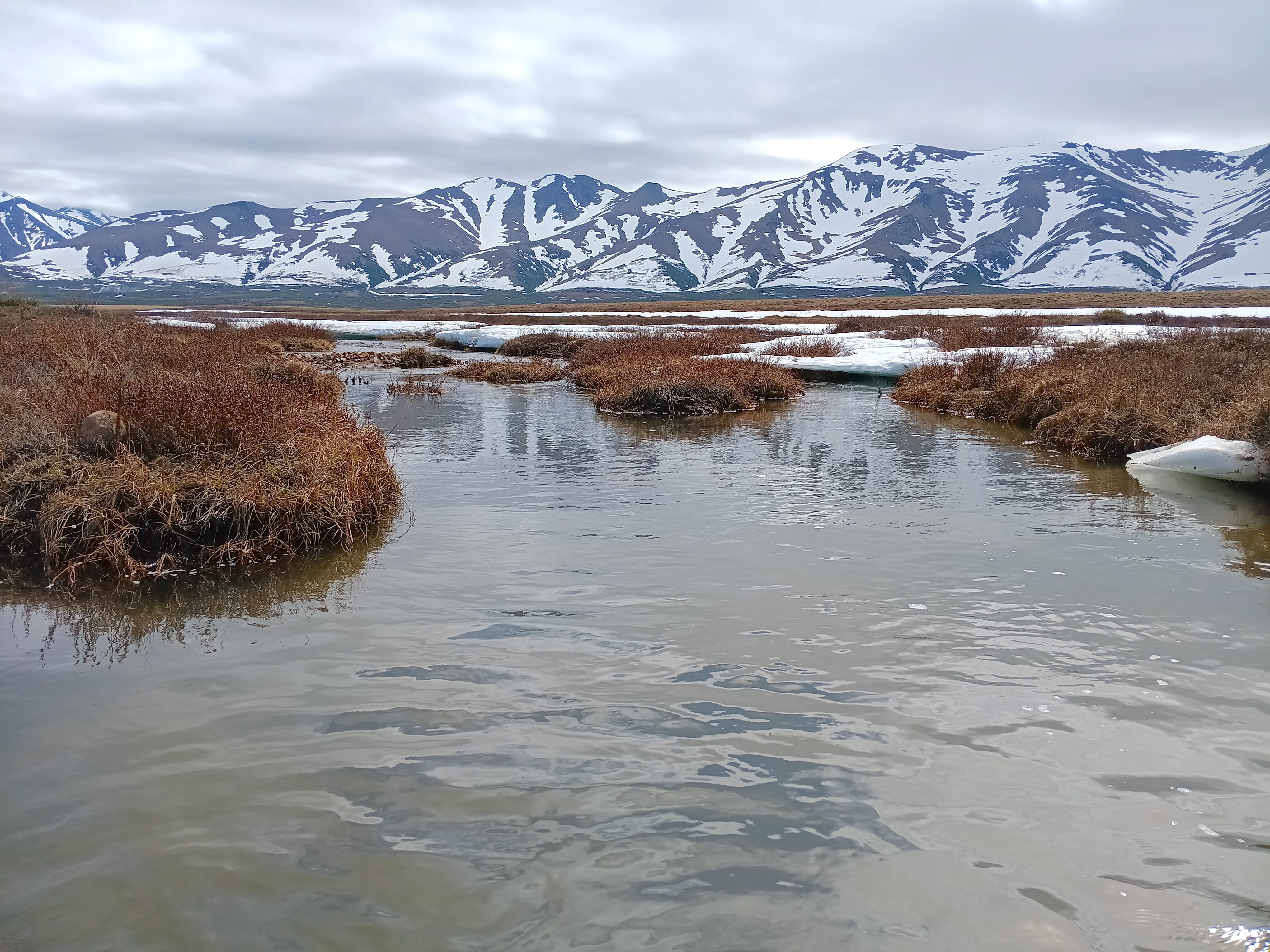
Graphite One, a Canadian-based mining company, is applying for a federal permit for a 1,176-acre, year-round open-pit mine in Alaska’s remote Kigluaik Mountains. Access to what is likely the largest graphite deposit in the United States will also require the construction of a 17.3-mile-long road cutting across salmon streams and archaeological sites, and water withdrawals from over a dozen streams, further jeopardizing already low numbers of chum and pink salmon returns at the exact time climate change is warming the Arctic.
The Native Villages of Teller, Brevig Mission, and Mary’s Igloo, and their partner organizations, have consistently opposed Graphite One’s permitting process, conducted by the U.S. Army Corps of Engineers, due to potential impacts on community health, subsistence, water, and cultural resources. And in recent weeks, that opposition has been mounting. On November 21, the Native Village of Brevig Mission Traditional Council and Village Corporation, and the City of Brevig Mission, unanimously adopted a resolution opposing the Mine. Then, the day before Thanksgiving, representatives from the City of Brevig Mission, the Brevig Mission Traditional Council, and the Native Corporation traveled across the ice-covered Grantly Harbor to meet with their counterparts in Teller to discuss further the impacts of the Mine. At the meeting, the Teller Tri-Entities and the Mary’s Igloo Traditional Council adopted more resolutions opposing the Mine and launched a comment-writing campaign for members of the public who attended. Then, on the following Friday, the three Tribes, along with the Norton Bay Watershed Council, submitted voluminous comments to the Corp, adding to a growing stack from other organizations and community members that point out multiple flaws in the Mine’s permitting process.
These flaws arise primarily out of the Corps’ obligation under the Clean Water Act to fully study the impacts of the Mine on the Imuruk Basin, an area that is almost as much water as it is dry land and is known as one of the most biologically productive and culturally rich regions in North America.[1]
The Tribes are primarily concerned that the agency is fast-tracking the application under the federal Fast-41 process,[2] and, ignoring proper analysis of environmental impacts in order to implement Trump administration executive orders favoring industrial extraction over protecting subsistence and cultural resources.[3]
A major component of the Tribes’ argument is that, to encourage the Corp to limit analysis of the Mine’s impacts, Graphite One has arbitrarily underestimated the potential impacts. Specifically, out of over 15,000 acres of land and waters within the Mine’s study area, Graphite One has estimated that the total extent of permanent impacts to wetlands and other waters would be a mere 414.68 acres and that only 2.21 acres of that are “jurisdictional” requiring analysis before the permit is issued under the Clean Water Act.[4]
The awkwardness of such low balling, however, is illustrated by a Jurisdictional Determination Report created by the consulting firm hired by the mining company to support its claim which concludes that the total extent of permanent impacts to wetlands and other waters would actually be 5,931.4 acres and the total jurisdictional waters would be 581.0 acres, greatly exceeding Graphite One’s estimated impacts.[5] In addition, while the Clean Water Act may limit environmental analysis to rivers, streams and wetlands that come under its jurisdiction, the National Environmental Policy Act requires the Corp to analyze impacts on dry land as well and therefore the entire 15,000 acres of the study area.
That the Corp appears to have bought into the ridiculously low levels of impacts of over a one mile wide mine and an over 17 mile access road as illustrated by an e-mail to the Nome Nugget newspaper sent by Graphite One Senior Vice President Kevin Trophy which states “after reviewing our project plan, the Army Corps of Engineers determined our project will not impact enough wetlands to necessitate an EIS…Given the very small wetlands footprint, the Corps made the initial decision to schedule the project as an Environmental Assessment (EA)…” thereby conveniently avoiding a complete analysis of impacts and a much reduced timeline for permitting.
To understand how this came about, one must first go back over the past decade or so, when a series of republican administrations’ primary tool for dismantling the Clean Water Act has been to drastically limit its scope.[6] Although Congress defined “navigable waters“ under the Act broadly to simply mean “Waters of the United States” (WOTUS), starting in 2001, a succession of U.S. Supreme Court opinions concluded that Congress’ use of the term “navigable waters,” somehow indicated an intent to restrict protections to only those waterways (including wetlands related to such waters) that have been traditionally navigable and ignored its previous finding that the term “navigable” was not that relevant to which waters were covered by the Act.
With 174 million acres of wetlands, more than three million lakes, and more coastland than the lower 48 combined, no other state has more to lose from weakening the definition of what can be covered by the Clean Water Act. Regardless, following last year’s decisions in Sackett v. Environmental Protection Agency, in which the Supreme Court cut back the application of the Act by restricting what can be considered WOTUS, the Trump Administration announced yet another rewrite of the Rule.
While the Administration claims to be implementing the decision in Sackett, in reality, the new Rule takes restrictions on the Act even further and would eliminate protection for the vast majority of wetlands throughout the Western U.S. and Alaska by excluding any wetland that does not have a continuous, visible surface connection to a navigable water. This would be the most restrictive reading of the Clean Water Act ever, pushing protections back to before they were even in place.
Because the Corp is one of two federal agencies that is directly involved in drafting the latest proposed Rule, it makes one wonder whether Graphite One’s outlandishly low estimate for the Mine, is because they have been working with the Corp to apply the highly restrictive definition of the draft Rule to such impacts even before it is finalized. This might explain why the mining company’s impact estimates differ even under the federal Fast-41 process and Trump administration executive orders that favor industrial extraction activities over proper environmental analysis of impacts on water and subsistence resources.
Either way, it is clear that the proposed Rule and the environmental impacts issue for the Graphite One Mine are linked and that the ultimate decision will come down from higher up, which will not be a good outcome for the local communities affected by the Mine.
Please Provide Comments on the Proposed WOTUS Rule
Public comments can be submitted on the proposed rule via Regulations.gov to Docket ID No. EPA-HQ-OW-2025-0322. The 45-day comment period closes on January 5, 2026.
[1] See generally, William Oquillick, People of the Kauwerak; Harold S. Shepherd, Return to Ekeunicks’s Time – Defending Waters and Tradition in the Arctic, pp. 63-88 (iUniverse, October 2024)(Return to Ekeunicks’s Time ).
[2] U.S. Department of Interior, Trump Administration Adds Key Mining Projects to FAST-41 Effort Aims to Expedite Critical Minerals and Secure Domestic Supply (April 18, 2025).
[3] See e.g., Immediate Measures to Increase American Mineral Production, Executive Order (March 20, 2025).
[4] Public Notice of Application for Permit - REFERENCE NUMBER: POA-2018-00210 – Graphite Creek at 2 (September 30, 2025)(Notice).
[5] Graphite Creek Project, Jurisdictional Determination Report Graphite One (Alaska), Inc. p. 42-43, Table 8 (August 25) (HDR JDR).
[6] Shepherd pp. 190 – 95.